CNN
—
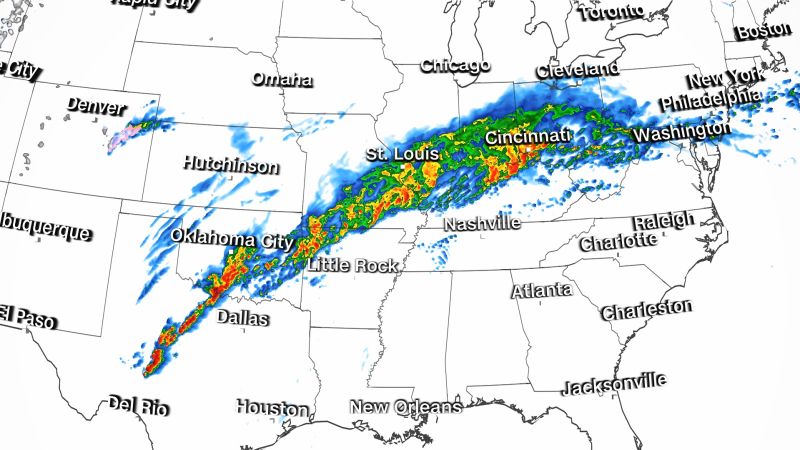
A strong storm system Friday will bring the potential for severe weather to 30 million people from the Lower Mississippi Valley to the lower Ohio Valley.
The National Weather Service has issued a tornado emergency – the highest level of tornado warning – for Rolling Fork and Anguilla in Mississippi. Rolling Fork is in western Mississippi, about 55 miles northwest of Jackson.
“At 8:06 PM CDT, a confirmed large and destructive tornado was located over Rolling Fork, moving northeast at 50 mph,” the NWS warning said.
The NWS later added that “a confirmed tornado caused damage in Silver City and Rolling Fork.”
The greatest risk of strong tornadoes includes more than six million people for places like Shreveport, Louisiana; Little Rock, Arkansas; Memphis, Tennessee; and Jackson, Mississippi.
“All those in the ArkLaTex would be advised to be prepared to receive warnings and have a shelter plan in place, with increased urgency directed towards locations with closer proximity to the Mississippi River Valley,” the weather service office in Shreveport warned.
A tornado watch has been issued for northern Alabama and middle Tennessee and is in effect until 3 a.m. CDT, according to the Storm Prediction Center. The watch covers more than three million people and includes Nashville, Tennessee, and Huntsville, Alabama.
Thunderstorms moving into the tornado watch area have the potential to produce tornadoes, large hail and wind gusts up to 75 mph.
“A few strong [to] intense tornadoes will be possible in this corridor with any persistent supercells later this evening,” the Storm Prediction Center said.
This is in addition to a tornado watch issued by the prediction center that includes east Texas, southeast Oklahoma, southwest Arkansas and northwest Louisiana.
“Storms are expected to intensify near and ahead of a cold front across the ArkLaTex region, with additional and somewhat more isolated storms possible by late afternoon,” the prediction center said.
The watch is in effect for over 2 million people until late Friday evening and is expected to produce hail up to 2 inches in diameter and wind gusts up to 65 mph.
“Overall severe potential including tornado risk is expected to increase as storms progress east-northeastward through late afternoon/early evening,” the SPC added.
While the most intense storms will occur during the evening hours, any storm through the day could launch a few weak tornadoes.
A tornado warning west of Dallas, led to a ground stop at the Dallas Fort Worth International Airport early Friday morning.

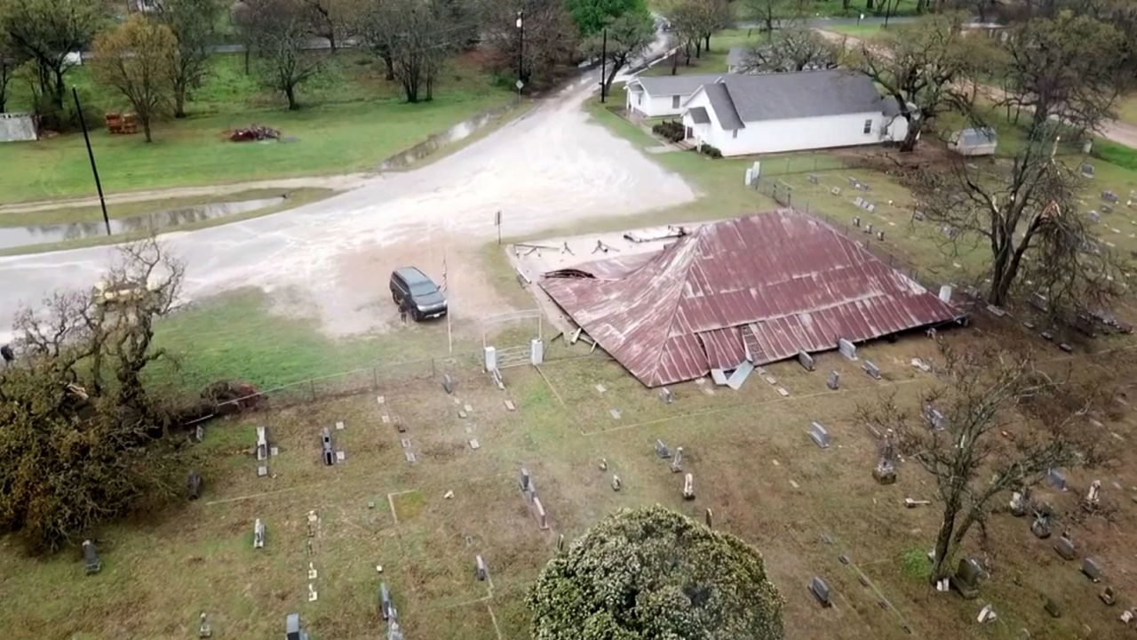
The National Weather Service says two separate EF-1 tornadoes struck Parker County, Texas, Friday morning. There was damage in the town of Poolville, including the destruction of the Poolville Tabernacle, a pavilion that is more than 100 years old, according to officials.
The storm also flipped over mobile homes in Poolville, but no serious injuries were reported, according to CNN affiliate KTVT.
“I ran down the hallway, but before I could get three feet, the whole house jerked to the side,” resident Eric Huntley told KTVT. “I balled up and I started hitting everywhere like a ping-pong ball.”
Get the latest forecast for your area here
Along with the tornado threat, there will be torrential rainfall that could lead to flash flooding.
The rain is expected across a large swath of the US stretching from Oklahoma to West Virginia.
Nearly 19 million people are under flood watches across at least eight states in the mid-South and central regions.
“A dangerous, flash-flooding and severe weather event is expected tomorrow (Friday), as heavy rainfall focuses along a slow-moving cold front across the Ohio Valley, while tornadoes, damaging winds, and hail develop south of the boundary in the Lower MS Valley and Mid-South,” the Weather Prediction Center warned Thursday afternoon.
The storm’s worst impacts were over the Oklahoma-Missouri border late Thursday, drenching parts of the states with 1 to 3 inches of rain in areas where a flash flood warning is in effect. Those same areas can expect another 1 to 3 inches of rain overnight.
In addition to the heavy rain, large hail is also a primary threat along with damaging winds and the possibility of tornadoes.
Flood watches extend for more than 1,000 miles from Oklahoma and northern Arkansas eastward to southern Missouri, southern Illinois, southern and central Indiana, Ohio and West Virginia. A flood watch means conditions are favorable for possible flooding, and it’s not a strong indication flooding will occur, the National Weather Service explained.
The significant flood threat is expected to shift from northwestern Arkansas to western Ohio throughout the day Friday. Storm totals between 2 and 4 inches of rain are expected, with the heaviest rainfall potentially exceeding 5 inches in total.
Note:- (Not all news on the site expresses the point of view of the site, but we transmit this news automatically and translate it through programmatic technology on the site and not from a human editor. The content is auto-generated from a syndicated feed.))


